
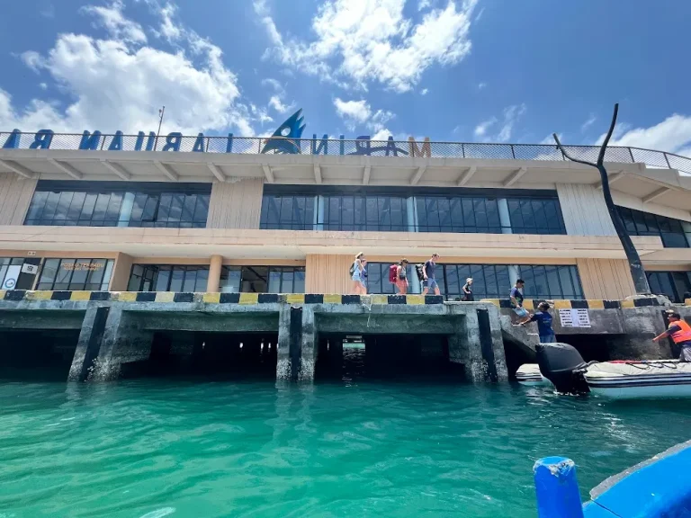
The Sailing Route from Labuan Bajo to Rinca Island
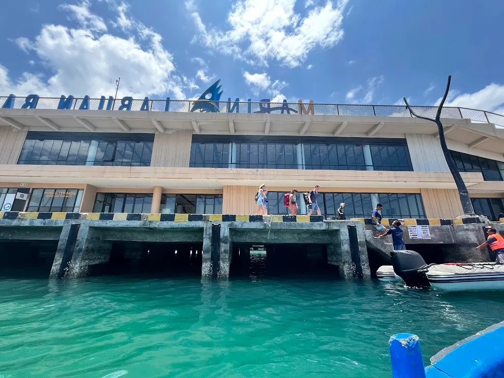
The sailing route from Labuan Bajo to Rinca Island crosses a narrow strait dotted with small islands, taking roughly 30-45 minutes by speedboat or 1.5-2 hours by traditional wooden boat, depending on vessel and sea conditions. The route threads between Flores’ western coast and a scatter of smaller islands before opening into the channel that leads to Rinca’s jetty at Loh Buaya.
The route, leg by leg
Boats depart from Labuan Bajo’s harbour, on the western tip of Flores, and head roughly southwest through a channel bordered by smaller islands before reaching open water in the strait separating Flores from Rinca. The final approach curves into a sheltered bay leading to the Loh Buaya jetty, Rinca’s only visitor landing point. The full crossing is a single, direct leg on most itineraries — additional stops (Kalong Island for the flying-fox colony, or a snorkel site) are typically add-ons rather than unavoidable waypoints.
Speedboat versus traditional boat timing
| Vessel type | Typical crossing time | Ride character |
|---|---|---|
| Speedboat | 30-45 minutes | Fast, can be bumpy in chop; less scenic transit time |
| Traditional wooden boat / phinisi | 1.5-2 hours | Slower, steadier, more time to enjoy the strait’s scenery |
Actual timing varies with sea state, engine power, and the exact route a specific captain takes, so treat these as typical ranges rather than a guaranteed schedule.
What the strait crossing looks like
The channel between Flores and Rinca is narrow enough that land is visible on both sides for most of the crossing — small, dry, hilly islands rising from calm-to-moderate water, quite different from an open-ocean passage. This is one reason the crossing feels manageable even to travellers nervous about boat travel: you are rarely far from a visible shoreline.
Tidal influence on the route
As covered in more depth on our marine hazards guide, tidal flow through this strait can be strong, particularly around narrower pinch points. Experienced captains time departures and adjust heading to work with the tide rather than against it, which is part of why crossing times can vary between otherwise similar trips.
Best departure time for the crossing
Early morning departures (typically before 8:00) offer the calmest water, before daytime wind builds, and align with the ranger-recommended early trekking slot on arrival. Afternoon crossings, especially in windier months (August-September) or wet-season conditions (December-March), tend to be choppier.
Alternative departure points
While Labuan Bajo harbour is the standard departure point for the vast majority of visitors, some multi-day liveaboard itineraries approach Rinca from a different direction after visiting other islands first (Komodo Island or Padar), rather than starting fresh from Labuan Bajo each time. The core Loh Buaya arrival point remains the same regardless of which direction the boat approaches from.
Navigation landmarks along the way
Boats leaving Labuan Bajo harbour typically pass a scatter of small islands used informally as navigation reference points by local captains, before the channel opens into the wider strait toward Rinca. On clearer days, the outline of Rinca’s hills becomes visible well before arrival, giving passengers a natural sense of progress through the crossing rather than an undifferentiated stretch of open water.
What crew do differently on rougher days
On choppier crossings, experienced captains adjust heading to take swell more directly on the bow rather than the beam (side), reduce speed to manage impact, and may reroute slightly to use any available lee (wind-sheltered) side of an island along the way. None of this changes the destination, only the comfort and duration of getting there — a genuinely rough-day crossing can take noticeably longer than the typical range stated above.
What to expect on your first crossing if you’re prone to seasickness
The relatively short duration of this specific crossing (well under the multi-hour open-ocean passages found elsewhere in Indonesia) works in favour of seasickness-prone travellers — even a genuinely rough day is a comparatively short ordeal. Taking motion-sickness medication roughly 30-60 minutes before departure, sitting toward the boat’s centre and low rather than at the bow, and keeping eyes on the horizon rather than a phone screen are the standard mitigations crew typically recommend.
Return crossing considerations
The return leg from Rinca to Labuan Bajo follows essentially the same route in reverse, though afternoon conditions (typically breezier than early morning across this region) can make a return crossing feel slightly different from the outbound leg on the same day. Multi-day itineraries that continue on to other islands rather than returning directly skip this return leg entirely for that day.
Frequently asked questions about the Labuan Bajo–Rinca Island sailing route
How far is Rinca Island from Labuan Bajo?
The crossing is a relatively short strait transit — roughly 30-45 minutes by speedboat or 1.5-2 hours by traditional wooden boat — rather than an open-ocean passage, since Rinca lies close to Flores’ western coastline.
Is the sailing route to Rinca Island scenic?
Yes — the strait is bordered by small, hilly islands for most of the crossing, offering consistent coastal scenery rather than open, featureless water.
Can the route to Rinca Island change due to weather?
Yes. Captains may adjust heading or timing around tide and wind conditions, and in more severe weather, departures can be delayed or rescheduled entirely for safety.
Do all boats to Rinca Island take the same route?
Most day-trip departures from Labuan Bajo follow a similar direct path, while multi-day liveaboard itineraries may approach Rinca from a different direction depending on which islands were visited beforehand.
How multi-day itineraries route differently
Rather than a simple there-and-back crossing, multi-day liveaboard itineraries often treat this route as one leg of a larger loop — continuing on toward Komodo Island or Padar after Rinca rather than returning to Labuan Bajo the same day. This changes the practical experience of “the route” from a single crossing into one segment of a longer sailing itinerary through the park.
Last updated: August 25, 2026.
For the full trip planning picture beyond the crossing itself, see how to get to Rinca Island and seasonal sea conditions. Most travellers book this route as part of a Komodo boat tour or Labuan Bajo yacht rental.
Quick Facts & Related Questions
- The sailing route itself runs about 30-45 minutes by speedboat or 1.5-2 hours by traditional wooden boat, depending on which type of boat your operator uses.
- Once the boat lands, trekking is ranger-guided along one of three marked loops at Loh Buaya — independent hiking is not an option on any of them.
- This sailing route covers one leg of a wider Indonesia trip, not a substitute for Flores, Bali, Lombok, or Raja Ampat — Rinca is a standalone stop inside Komodo National Park that most itineraries add rather than swap in.
Keep Reading

Itineraries & Routes
Half Day or Full Day on Rinca? Honest Comparison
A half-day trip covers Rinca Island alone: boat out, trek, boat back, done in roughly 4-6 hours including crossing time.…

Itineraries & Routes
How to Avoid Crowds on Rinca Island
The single best lever for avoiding crowds on Rinca Island is timing your arrival session — the park runs visits…
Itineraries & Routes
Beyond Rinca: Flores, Alor & Eastern Indonesia After Komodo
A Rinca Island trip departs from Labuan Bajo, which sits at the western tip of Flores — itself a large…